
On this page: TENNESSEE Homestead
Latest update: Friday, 11 November, 2016
Family members referenced on this page:
• Adam EDGAR and Mary [UNKNOWN] EDGAR family
• James EDGAR and Selah WITHERINGTON EDGAR family
• Joseph WITHERINGTON and Isobel TAYLOR WITHERINGTON Family
• Ambrose HADLEY and Nancy BUSTIN HADLEY family
Find details, photos, and sources in the Family Tree Database.
Each of the five known children (who grew to adulthood) born to Adam EDGAR and Mary [UNKNOWN] EDGAR were born in
Chester County, SOUTH CAROLINA between about 1770 and 1790.
• William, abt 1770
• Margaret, abt. 1775
• John, abt. 1777
• Abigail (Abt. 1785 – Bet. 1850/1860)
• James (1790 – 1869)
Shortly after their mother Mary died, all five of Adam's and Mary's children migrated to TENNESSEE, in late 1804 or early
1805. "The Covenanters all left the country [SOUTH CAROLINA] early in the present century on account of the institution of
slavery." (Early Associate Reformed Presbyterian, LATHAN, 1888 #7)
In October 1813, William bought land on Liepers Creek (sometimes called Liepers Lick Creek) in far northwestern Maury
County near the present community of Fly. This land was very near land eventually settled by the HADLEY, WITHERINGTON
and WOOLARD families, later connected to the EDGAR family by marriages.
On 11 March 1818, about the time he and his family were relocating to southern ILLINOIS, William sold the land he owned in
TENNESSEE to his younger brother, James EDGAR, who was then living on that land with his wife, Selah WITHERINGTON
EDGAR, perhaps in the same house that William had built after relocating there from SOUTH CAROLINA in about 1809.
(Maury County (TENNESSEE) Deed Book G, p 393) James' and Selah's son Joseph (b.1818) was either an infant or was
about to be born. James and Selah and most of their children continued to live on that land until they relocated to TEXAS in
late 1853.
Margaret EDGAR LITTLE and her husband Samuel LITTLE and their family members relocated to middle TENNESSEE
about 1809 and then to southern ILLINOIS about 1818. Both moves were probably made with William EDGAR and his family.
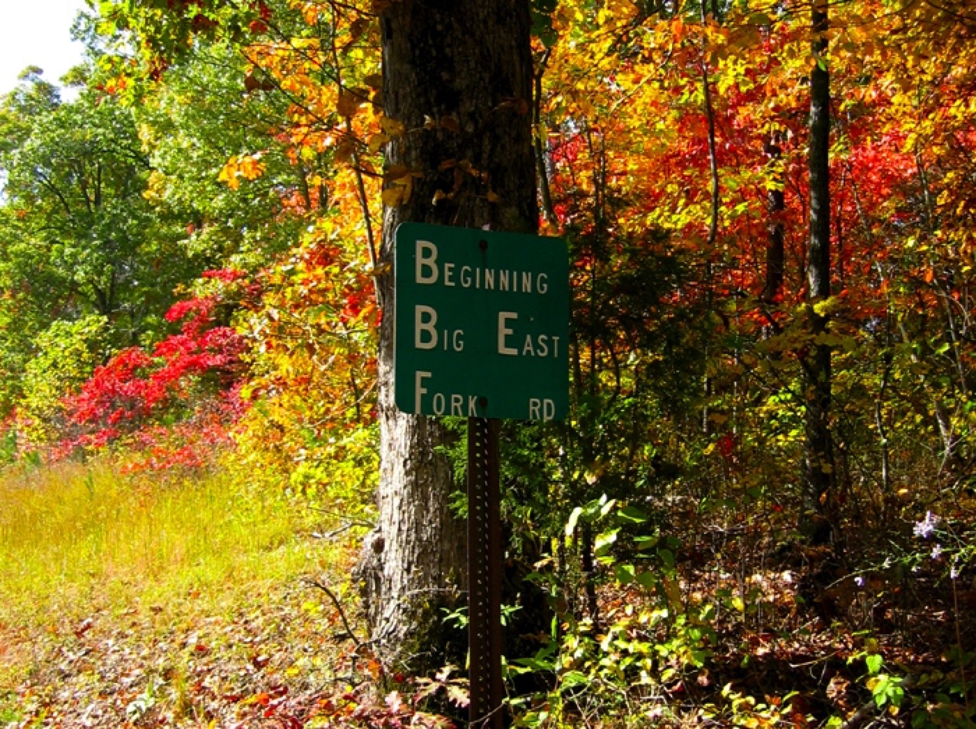
John and his wife, Mary, relocated to TENNESSEE
about 1809 and bought land in Williamson County
on the Big East Fork of the South Harpeth River.
In 1809, records show John EDGAR bought
120 acres in TENNESSEE; the land is
adjacent to, and on the west side of the Big East
Fork of the South Harpeth River (now called Creek).
1809,120 ACRES: The oldest land record found for John EDGAR in TENNESSEE shows an 1809 transaction recorded in the
Williamson County Deed Book B, on pages 204-205. That record documents a transaction in which Robert McMILLAN sold
120 acres of land on the East Fork of the South Harpeth River to John EDGAR for $320.00. That transaction occurred 10 Jan
1809 and was registered in the Williamson County records 05 Jun 1809.
Abigail and her husband Philip WALKER, relocated about the same time as her siblings, 1809, but to Davidson County,
1826, 100 ACRES: Land Grant Dated 13 Jan 1826 (21 Jan 1826?). This was for 100 acres of land on the East Fork of the
South Harpeth River adjacent to the original parcel of land on which John EDGAR and his family were living at the time of this
land grant. It was granted in consideration of the sum of $1.00 (one cent per acre). (source: Bob WEBB, October 2006)
This map shows a segment of an 1878 map of Williamson County, TENNESSEE (far northwest corner).
From descriptions in the various documents that refer to John EDGAR's three parcels of land, and with
some keen observations and notations by Kay KING, the locations of the three parcels of John EDGAR's
land in Williamson County were found. They are marked on this map with three red dots marked “E.” Note
that on most any map, even modern maps, this location in far northwest Williamson County is easy to find,
because the East Fork of the South Harpeth River (now called “East Fork Creek” on modern maps) flows
almost due south from where the Davidson County line dips in a flat-bottomed “V” into Williamson County.
That “county line dip” is clearly shown on this enlarged portion of the 1878 map. (source: Robert WEBB,
October 2006)
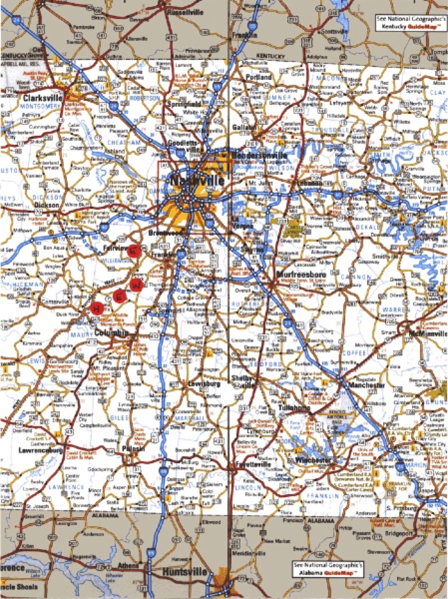
The second map shows a bigger picture perspective, on a modern map. The county line dip is also shown on
this map although it’s much smaller and harder to see, but look for the faint blue county line right above the
top red dot. Also note on the modern map, the proximity of the Natchez Trace to these parcels of land owned
by our ancestors. The new route of the Natchez Trace is shown on the map, but other maps show that the
new route follows very closely to the original route in this section of the Trace.
• On this map, the general location of all three of John EDGAR's adjacent parcels of land is shown with one red dot between
Franklin and Fairview, TENNESSEE. In addition, we can get a good perspective of just where the land really was relative to
present day Nashville, TENNESSEE and Huntsville, ALABAMA.
• The red dot marked with a “W” just south of the first “E,” shows where Joseph WITHERINGTON and Isobel TAYLOR
WITHERINGTON and their family (including their daughter Selah who married James EDGAR) settled in 1813 after relocating
to TENNESSEE from NORTH CAROLINA.
• The red dot just southwest of that dot, also marked “E,” shows where William EDGAR bought land upon relocating to
TENNESSEE in about 1809, land later owned by James EDGAR and his wife, Selah WITHERINGTON EDGAR, where they
resided and raised their family (nine boys and one girl) prior to their relocation to TEXAS in the mid-1800s (most came in late
1853).
• The red dot most southwest and marked “H,” [CORRECTION BELOW] shows where Ambrose HADLEY Jr. and Nancy
Dodson CALDWELL HADLEY owned land and where they raised their family including James D. EDGAR's future wife, Martha
Jane HADLEY, whose hand made coverlets are on display in the Yoakum Heritage Museum (Refer to the Family Tree
Database.) with the notation that she lived in the Snow Creek community when she “rode 30 miles on horseback to take
lessons in the craft.” Ambrose died young, and Martha Jane, being the oldest child, stayed in TENNESSEE to help her mother
raise the other children. (source: Robert WEBB, October 2006)
[CORRECTION Sunday, 11 October, 2015 The H red dot is misplaced.
Based on new knowledge and fine honing, we now know it should be SE
of the E red dot and not SW of it.]
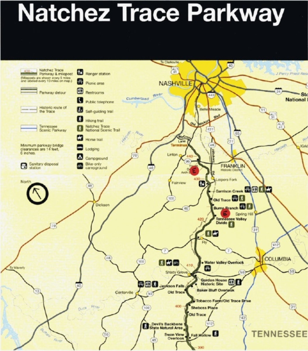
I became so intrigued by the proximity of our ancestors’ land to the Natchez Trace, that I have
marked a map of the Natchez Trace Parkway with the locations of John EDGAR's land in
Williamson County east of Franklin and William EDGAR's (later James EDGAR's) land in
Maury County not too far south of John's land. Note that this third map is not oriented with
north being straight up. Rather, it is oriented with the route of the Trace shown more vertical.
In this map, north is a little to the left of vertical. (source: Robert WEBB, October 2006)
Sources
Research of Robert Merritte WEBB